|
|
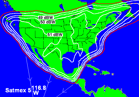
SATMEX 5 Satellite map - Ku 1 beam coverage map
SATMEX 5 is located approx due south of you, if you are on the west coast. Elsewhere the view to the satellite is generally towards the south west.
Hughes 601 HP. 7kW payload power. This satellite was launched using an Ariane rocket on 5 Dec 1998. Now in geostationary orbit and stabilised at 116.8 deg west longitude or 243.2 deg east longitude. Fuel for 15 years lifetime.
C band: 24 x 36 watt transponders. Two coverage beams: Ku1. North (shown above) and Ku2. South
Ku band: 24 x 132.5 watt transponders.
For Ku 1 beam coverage shown, and referenced to 51 dBW contour, typical parameters are:
Down link: EIRP = 51 dBW Up link: G/T = +4 dBK PFDsat = -97 dBW/m^2.
Single carrier operating point is 0 dB input back off and 0 dB output back off, using ALC
Multi-carrier operating point is -8dB input back off and -5dB output back off. C/Intermod = -18 dB.
|
Page started 9 Dec 2003, amended 27 July 2015, 8 Mar 2024 |