Satellite maps: geostationary orbit views from 60 to 110 deg east longitude
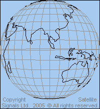
View point height = 35786 km above the equator. Sub satellite point is on the equator at the same longitude as the satellite. Elevation angle to the satellite is zero at the map edge.
The orbit range between 57 deg east and 66 deg east is particularly important as satellites in this arc provide single hop connectivity between Europe (UK, France, Spain, Germany), Africa (South Africa), North East Asia (Japan, China) and south East Asia (Australia, Indonesia). This part of the geostationary orbit arc is called the Indian Ocean Region (AOR)
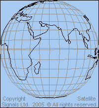 View from above 60 deg longitude |
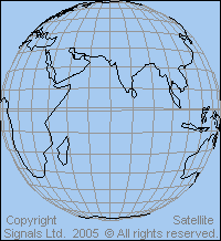 View from above 70 deg east longitude |
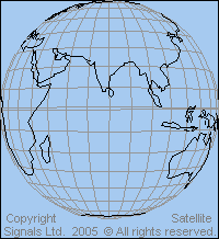 View from above 80 deg east longitude |
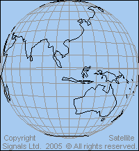
 View from above 90 deg east longitude |
 View from above 100 deg east longitude |
 View from above 110 deg east longitude |
Links: Details of beam coverage maps for particular satellites for the Middle East
and satellites for Asia and Australia
|
► Page created 4 October 2005, amended 6 June 2021, 10 May 2026. All pages on this satsig.net web site are Copyright Satellite Signals Limited © 2005 all rights reserved. |